Showing posts with label Tunisia biking. Show all posts

Monday, 28 September 2015

Mountain Biking: Ghardeya Circuit - Nabeul


Distance: 8km
Time: 30 minutes
Difficulty: easy
Altitude difference: 85m up and down

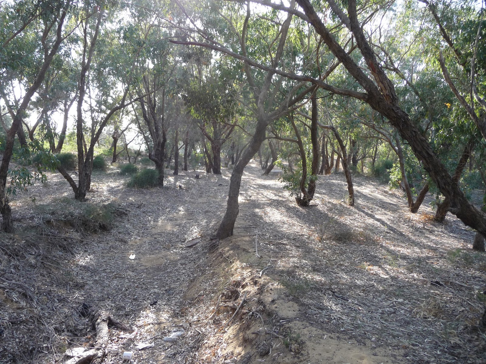
This is an easy going, fun trail and potentially fast if you’re up for it. The route goes through beautiful and typically Tunisian style forest (mainly eucalyptus) and is unspoilt by polution. Great ride all together!


Finding the trailhead of this mountain bike route is a little bit difficult. From Tunis or Hammamet, go in the direction of Nabeul. Around Nabeul there is a bypass road that heads into the direction Korba. After Nabeul look out for the signpost for Somaa in a left direction (at a roundabout). Follow this road. After the turn-off to Somaa stay on this road for 1.5km. Look out for a spray-painted sign VTT in green on the left. Take this dirt track and follow it for about 500 metres. Keep left and find a place to park your car or hit the trail straight away if you’re by bike.

The trail first heads into westerly direction with a very sandy start. 100m after that it turns southeast. The track is wide and solid with only a few sections of sandy bits, nothing major. After roughly 1.7km the road bends in northernly direction where it forks. Take the sharp right turn going direction south again which is the start of a fun downhill section.

The track bends right to the north again and now it’s a bit of a climb in open terrain. Keep right when the track forks. A small steep climb follows. It levels out after that. For about a kilometre it’s a pretty straight stretch of trail. Then at the T-junction, turn left. Now the road curves around the hill side. The last section of the loop has a few short sandy sections. Stay on the main trail that leads to where you started.


Monday, 1 December 2014

Mountain biking: Lac Tunis - Chikly Fortress

Distance: 17km
Altitude difference: 0m
Terrain: dirt track
Technical difficulty: * (out of *****)
Notes: sometimes dogs on the causeway, Guard National may be difficult
GPS track


This is probably the best traffic free bike ride in Tunis. The start of the ride is at the northern connection (a canal) between Lac Tunis and the Mediterranean, at the bridge next to the roundabout and the causeway road between La Goulette and Tunis TGM. There is no official car park, so it's best to park your car in La Goulette. There is a Guard National post at the entrance to the causeway to Chikly. I asked permission and it was fine. Coming back to report my return, another official told me it was forbidden and I would need a permit from the Ministry of Environment, Culture and Internal Affairs. Just take your chances, I've heard many people do it and have no issues.


Chikly, a fantastically restored 16th century fortress in the middle of Lac Tunis

The ride to the fortress is very easy. It's all flat with some potholes and bumps. Along the way you will see fishermen at their improvised huts, waiting for the catch of the day. On your right you will pass Lac 1 and Lac 2, the principle business centre in the country. On your left you can see the causeway road towards Tunis Centre. And as the dirt track is crossing the flight path of the planes bound for Tunis Carthage, you will see many planes flying very low.


The author reaching Chikly Fortress

The fortress itself, which you will reach after about 8km, is spectacular. See here for some background information about the fortress. It was "guarded" by a big flock of flamingos. Take your time to explore the building, and there's great views from the top. Go back the way you came (or go for a swim!) as Chikly is an island and the end of the dirt track. This bike trip is a true gem and a must do for cyclists in Tunis!


Friday, 14 March 2014

Mountain biking: Bizerte to Ras Angela

Distance: 42km
Altitude difference: 570m
Terrain: forest and country track, sandy sections
Technicality: ** (out of *****)
GPS data


This brilliant route takes you from the Maison de Jeunesse in Bizerte to the wild and windswept beaches northwest of the city. You could skip the city part by parking at the edge of the pine forest.

Once you left the urban area, you start climbing a fairly steep, rough road through the forest. There's a great viewing point where the track flattens a bit. A short downhill with a small section of single track brings you back to civilisation (the village of Nadhour). In the village turn right at the T-junction and go back to the forest. This is the home of a fast competition course held in March 2014. There great bits of single track on the side of the dirt road. At the first junction you can either go up and climb towards the navy station looking over Cap Blanc (recommended!). Return to this junction again. The at times rough track turning left stays in the forest and eventually leads to an open area where you can see the Mediterranean. A challenging downhill with sandy section leads to a main junction where you turn right. Follow this route (check for some great single track on the side!) which goes all the way to Ras Angela and the lighthouse. A view of the truly wild and virtually unspoilt coastline is your reward.

Backtrack your route for around 9km to the junction after the challenging downhill. Here, turn right. A very long climb takes you back to the tar road for a little bit. At the T-junction, turn left (you will pass the Bizerte prison). At Nadhour, backtrack the forest track (the first long climb). Great, fast downhill back to Bizerte!

Sunday, 9 February 2014

Mountain Biking: Mrezga Loop

Distance: 16km
Altitude difference: 410m
Terrain: wide forest track with deep trenches, big rocks and sandy sections
Technicality: **** (out of *****)
GPS data


The route seen from Mrezga

Time to hit some technical trails! This loop (almost) has it all; steep technical climbs, hairy fast descents with deep trenches and big rocks and flatter sections for speed.

Park you car at the bottom of the hill at Mrezga, just east of Hammamet (best is to use the GPS data as a reference). The route we took was great, but it may as well have been one of the other many tracks that snake through this small hilly area. Our route is essentially a loop around this broad valley. Staying on your bike is the biggest challenge when going up. If you choose the right line, it's all rideable. The descents, especially the final descent, are fast with loose rock and gaps. Take care! It's a lovely ride and easily accessible. 

Monday, 23 December 2013

XC Mountain Bike Race, Rades Forest - Tunis


Distance: 8km
Altitude difference 125m
Terrain: desert: dirt track, single forest track
Technicality: ** (out of *****)
GPS data


The men, about to be released...

On 15 December 2013 the very first XC mountain bike race took place in Rades Forest in Tunis. Tunis based bike shop Espace Velo sponsored this event and I think they created the 8km XC route as well. The course was fast, with small technical sections and scenic. I truly enjoyed riding the 4 rounds despite my broken gear cable in round 2 (who needs gears anyways??). See below for the trail map.


Thursday, 27 June 2013

The plan: single track mtb park Sidi Bou Said

Deprived from mountain biking for a while now, I see potential trails everywhere. The area that is on the radar for a while now is an awesome bit of no-mans land between Sidi Bou Said and La Marsa. It's a roughly 15ha woodland with both pine and deciduous trees and is situated on a hill with about 40 metres maximum hight difference. Currently the woodland is a wasteland, owned by the Tunisian government. It is a shame it's not being used, apart from some folk who secretly drink and make a mess of this wonderful spot.

Potential bike heaven

So I've taken up the task to try and convert this bit of land into a mountain bike park. This week I've been exploring the area and got really psyched about the incredible potential this place has. Although the altitude difference is not big with creative trail design you can build swooping trails through the trees, lot's of interval up and down and make maximum use of the slope. The vegetation is not thick so in theory trail building can start tomorrow. But as it would be great to promote the sport and get the Tunisians to get a taste for biking, I'll go through the proper procedure to realise the project.

Beautiful trees and cactus in Sidi Bou  Said woodland

So the first step is to find the right people to talk to. I am in touch with local cycle enthusiast and campaigner Adel Beznine who may be able to point me in the right direction.

A random projection of trails, just to show you can squeeze 4km of single track out of this bit of forest easily. And plenty of room for extensions on the opposite side of the road!